
July 2021
The site was purchased by Sydney-based developer Ilya Melnikoff in July 2021 for $16.65 million. This will be only their second project in Melbourne - the first being in Albert St, East Melbourne.
The 1400 sq m site was acquired from Melbourne developer V-Leader, which paid $11.2 million for it in 2017.
The development will be re-branded as Pier…
Surely such a grandly named boulevard would be one of the more prominent streets in Port Melbourne. Nothing could be further from the truth.
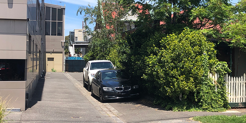
Barkly Avenue is a short laneway off Garton Street, tucked in behind Crockford Street.
It is named in honour of Sir Henry Barkly who was Governor of Victoria when the Borough of Sandridge gained separation from…
Two streets, one in Port and one in South Melbourne, as well as a section of Port Melbourne's Railway Reserves, bear the name Smith. And that doesn't take into account the curious occurrence of, what is now, Frangipani Court also being referred to as Smith Street in the Sand's & McDougall Directories from 1915 to 1974.
But why are…
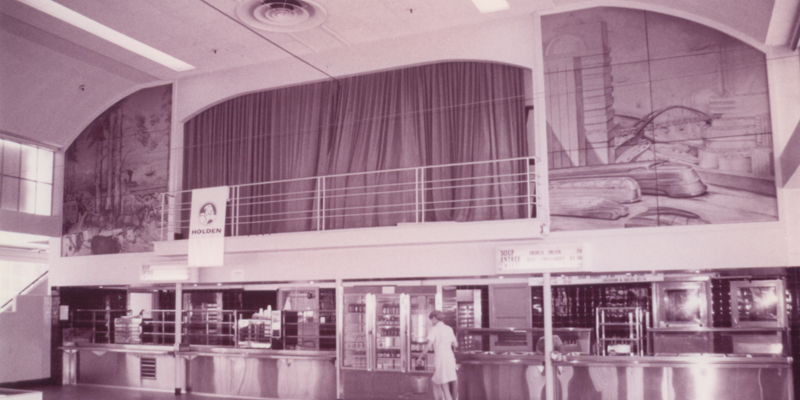
Former GMH Social Centre. Photograph by David Thompson.
The former General Motors-Holden Social Centre is tucked away off Salmon Street.
Constructed in 1945 by Richmond builder, E A Watts Ltd, the building hosted concerts, balls and all manner of GMH employee functions but, primarily, was their canteen. Typical fare in the mid-1990s included French Onion soup (70c), Beef Stroganoff ($3.50) and…
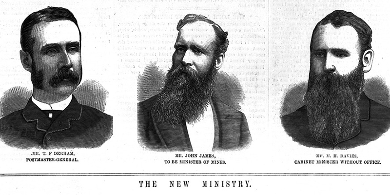
Frederick Thomas Derham was born in Somerset, England, in 1844 and arrived in Melbourne with his family in 1856. Derham's first business undertaking was as a mercantile broker with Callender Calwell & Co. In 1864, he married Ada Anderson with whom he had three sons and a daughter. Ada died in 1874.
Derham had met Thomas Swallow, founder of Swallow…
Research by David Radcliffe and David Thompson
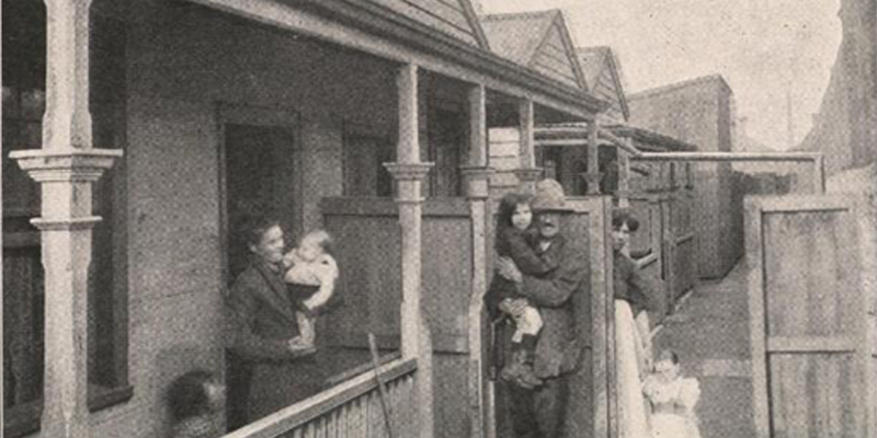
In July 2021, Allan Marshall posted a photograph of Doubledan's Lane, Port Melbourne from Building and Real Estate magazine, February 1916 (above) on the Born and Bred in Port Melbourne Facebook page stating that he had checked period maps but couldn’t find any mention of the location. Allan posts old photographs of Port on…
by Vicki Radcliffe
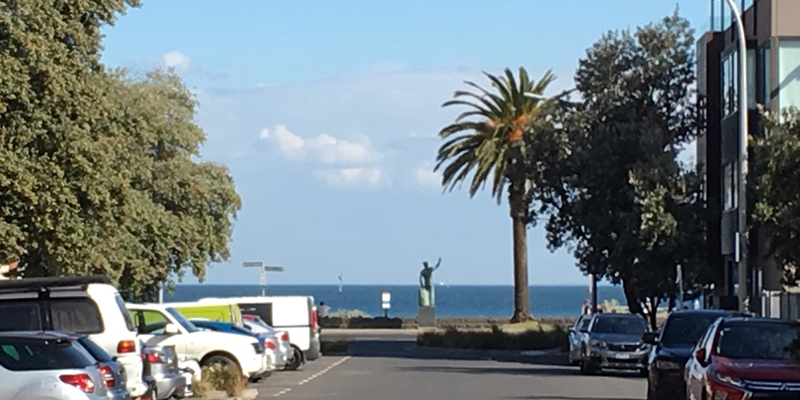
When Margret Bride announced that she would be looking for new members to do a short presentation on their favourite Port Melbourne place, I immediately thought of the foreshore of Port Melbourne beach and, more specifically, the bronze memorial statue of a sailor looking outwards to the bay.
This statue intrigued me right from the first time…
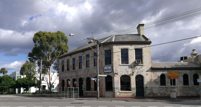
Crockford St is more of a street section than a street in its own right, connecting Bay St to City Rd. It runs for a mere 300 metres between Raglan St and Boundary St.
Marking the place where Bay St and Crockford St divide is the Fountain Inn at 1 Crockford St.
The Fountain Inn
Brothers John Edward and Edward James…
by David Radcliffe
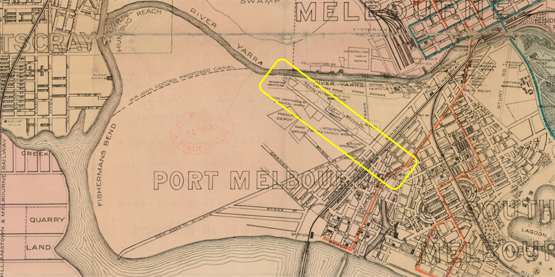
Ingles Street is parallel to, and a block south of, the northern boundary between Port Melbourne and South Melbourne. When gazetted in 1860, it only ran from the eastern boundary with Emerald Hill (South Melbourne), past the upper arm of the Sandridge Lagoon to Evans Street, just over the Melbourne and Hobson’s Bay Railway. Pickles and Boundary…
by David Radcliffe
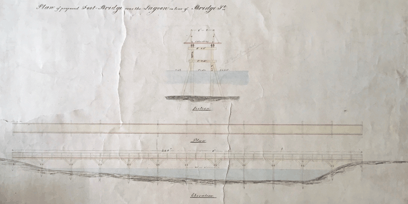
Bridge Street is one of three streets that both traverse Port Melbourne from east to west, cross the light rail tracks and extend into Fishermans Bend, the others being Ingles Street and Graham Street. Originally it only ran from the western edge of Sandridge Lagoon to the Melbourne to Hobsons Bay Railway track. As there was no…