Out of Sight, Out of Mind
Melbourne’s Sewer Mains in Port Melbourne
Instalment 2 of 3. The “Melbourne Main”
by Richard Olive
RECAP
The initial instalment of this series provided some basic information about sewers in general and the layout in Melbourne in particular. It explained how two of the city’s main sewers, “The Melbourne Main” and “The Hobson’s Bay Main” run right through Port Melbourne. These mains have been quietly serving their function for well over a century. This instalment will focus on the Melbourne Main, describe its very troubled construction, the calamity it delivered to Ross Street, and its eventual replacement in recent years.
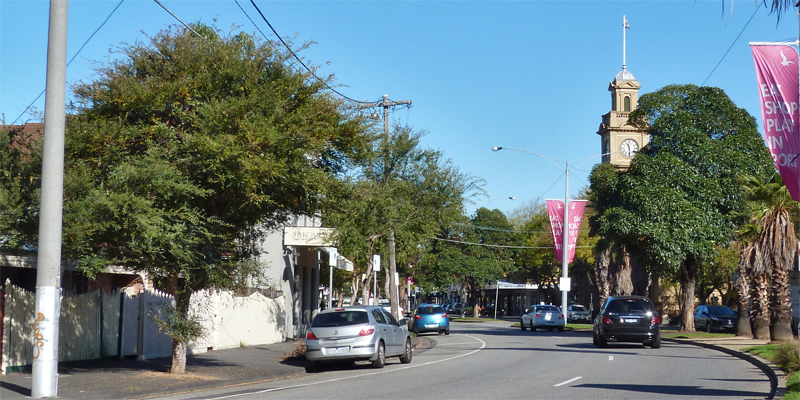
As its name implies, the Melbourne Main carries the sewage of the city proper plus the closely adjoining areas of East, West and North Melbourne, plus Docklands. It runs beneath the length of Flinders St, crosses under the Yarra adjacent to the Spencer St Bridge, proceeds under what is now the Montague St interchange, then via Johnson St and Normanby Rd, before finally entering Port Melbourne as it crosses Ingles St. From there its route is direct: it simply follows Ross St all the way to its confluence with the Hobson’s Bay Main near the Port Melbourne Tennis Club. The junction in fact lies beneath the nature strip of Swallow St, near the intersection with Australia Circuit. An old vent stack still marks the spot. Although that final 1.2 km might have been direct, it was to constitute one of the most formidable tunnelling challenges ever encountered to that time.
Construction
The contract for the Port Melbourne section of the Main was let to Messrs H. McKenzie and Sons on 22 January 1894, and was completed on 12 December 1896, for a sum of £48,781 5s 7d, which seems a pittance by the standards of today’s tunnelling costs. Let’s hope that we got value from those final seven pennies!
On average, the tunnel was some 13 metres below surface level, sloping downwards at an average of 1 metre in every 750 metres. Although the final diameter of the sewer was only 1.0 metre, the tunnel was excavated to 2 metres, the smallest size in which men could work upright, and the smallest size to which the shield (see below) could be steered on line and grade. The annular space was filled with any or all of steel shell, brick, stone or concrete blocks.
Tunnelling Challenges
The first 150 metres of the tunnel, from Ingles St to about Raglan St progressed satisfactorily, as the alignment passed through solid rock. But south of Raglan St conditions deteriorated. For the remaining length of Ross St, the ground consisted of nothing but fine, black saturated silt. This is the very worst environment for tunnelling, the ground having no capacity to stand without caving, but rather continuously threatening to flow in upon the workers. William Thwaites, the chief engineer of the MMBW had no hesitation in declaring the length of Ross St to be more treacherous than all of the other Mains throughout greater Melbourne put together.
The solution adopted to allow tunnelling through this oozing muck was the adoption of a “shield”. In essence, the shield is a heavy metal cylinder, of a length about equal to the diameter of the excavation. It could be jacked forward into the silt by hydraulic rams pushing off a ring of previously placed concrete lining blocks. Workers within the shield could then shovel silt from the soil face into small rail carts which would dragged back to the previous access shaft. From there the muck would be hauled to the surface for disposal.
Given that the tunnel was well below the elevation of the sea or the Yarra, the groundwater within the soil was inevitably under pressure, always threatening to cause an inrush. To counter this, variants of the initial shield were equipped with a pair of diaphragms, each with hatchways to allow access, so that air could be pumped to the face at a higher pressure than the groundwater, to prevent inrush. Of course it was essential that the two hatchways were never opened simultaneously, so that the air lock was always maintained.
Given that the ground lacked any inherent strength, that the processes and equipment were so novel, and that the methodology lacked any scientific understanding, it is not surprising that calamities occurred. The situation was well-described in an article which appeared in the Age on 23 April 1896:
A WRECKED STREET
Serious Effects Caused by Sewerage Works
Messrs M’Kenzie Bros’ contract for the construction of the branch of the main sewer under Ross Street, Port Melbourne, has been a most unfortunate one for the contractor from the outset, and now that it is nearing completion the appearance of the buildings on either side of the thoroughfare speaks eloquently of the nature of the country met with. Sand, slush and an abnormal quantity of water have retarded the progress of the work throughout, and more than one shaft has fallen in. The first outward sign of the treacherous substrata was afforded soon after the commencement of the work by serious depressions on the face of the roadway; later, as the surrounding country drained into the workings, the footpaths, previously level, presented a downgrade from the building line to the channelling, and next a cottage was observed to have exhibited a grotesque determination to rub corners with a neighbouring building. The latter, not to be behindhand in accepting the overtures of its neighbour, leaned bodily in the direction of the cottage, and then here and there in various spots in both Ross Street and Graham Street tenements began to nod to one at the other in a style suggestive of a party of roystering Bacchanalians who had been indulging in the “scarecrow dance,” and had suddenly become transfixed in very inconvenient attitudes. It was a very ridiculous sight altogether, but it was no laughing experience for the owners and the occupiers of wrecked buildings.
The council surveyor reported that a five-roomed brick cottage at 84 Ross Street had sunk bodily some 8 inches at the front and something less at the back. The subsidence had reversed the fall of the gutters, and as a consequence the interior of the place was flooded. The ceilings showed ugly fissures, and the floors were twisted out of their levels A house at 70 Ross Street had fallen 2 feet 2 inches on one side and 1 foot 4 inches on the other, with the result that the frame of the building was thrown out of shape, and the house was not fit for habitation. At the corner of Ross and Clay Streets a two-roomed cottage had taken a sudden dip of 18 inches. The occupants were driven out by the storm waters which had flooded it. At 68 Ross Street a five-roomed weatherboard house followed the subsidence of the soil beneath it by 16 inches, when, perhaps feeling tired by its exertions to retain its equilibrium, it took up a reclining attitude. . . . . A block of two shops and one house at Nos 78, 80 and 82 Ross Street suffered very greatly. The shops sank irregularly about 12 inches, while the house now stands 2 feet 3 inches below the level, and has been so twisted and distorted that it impresses one as a worthy trophy saved from some earthquake ridden city. [Those two shops and that house were demolished and the Chapman Memorial Hall, still standing, was constructed on the site over the next couple of years.]
The science of geo-mechanics was unknown at the time, and there was little experience anywhere with shield tunnelling through saturated silt. It can validly be claimed that Ross St was the site of ground-breaking engineering on the international stage. As such, one should not be surprised that the end result was less than perfect. Thwaites describes in some detail experimentation with the shield and the difficulties of keeping it on line. In all, some seven different shields were fabricated and deployed. The shields tended to sink below the constant design slope, so that the finished tunnel had a certain waviness, which eventually led to variations in depth of the flowing sewage. This caused difficulties for inspection and maintenance. Never-the-less, the Melbourne Main served its function for well over a century.
Modern Day
Finally, the great surge in the number of residents in the CBD and in Docklands at the start of this century meant that the original old Melbourne Main would be under-capacity and would have to be replaced. This occurred in 2012. The replacement was driven not along Ross St but a parallel route along Walter and Turner Reserves, adjacent to the light tram tracks. The Ross St main continues in a reduced role, becoming part of the reticulation and service mains feeding the new Melbourne Main.
By contrast to the old main under Ross Street, the new main benefitted from a century of technological advance, and was driven bullet straight, and to a perfect 3 metre diameter, by a modern tunnel boring machine – no inflows, no subsidences, no manual labour, no sweat.
One small, but crucial, part of the historic main was not replaced and remains in service to this day. That portion is the downstream extremity, where it joins into the Hobson’s Bay Main. At this location the tunnel lining is formed in elaborate brickwork. Melbourne Water feared that any attempt to interfere with that brickwork would lead to its collapse, creating a blocked sewer for over a million Melbournians. So, the solution was to join the new Melbourne Main into its historic predecessor a short distance upstream. This is under the nature strip on the north side of Swallow St, near the tennis courts. A new vent pipe, complete with exhaust fan, marks the spot.
The final instalment in this series will cover the Hobson’s Bay Main and its disastrous crossing beneath the Yarra. It will also reflect on working conditions in these tunnels and conclude that the achievement of the workers was truly heroic and deserving of much more recognition from us, the beneficiaries of their toil, over a century later.


