Lyons Street
by David F Radcliffe
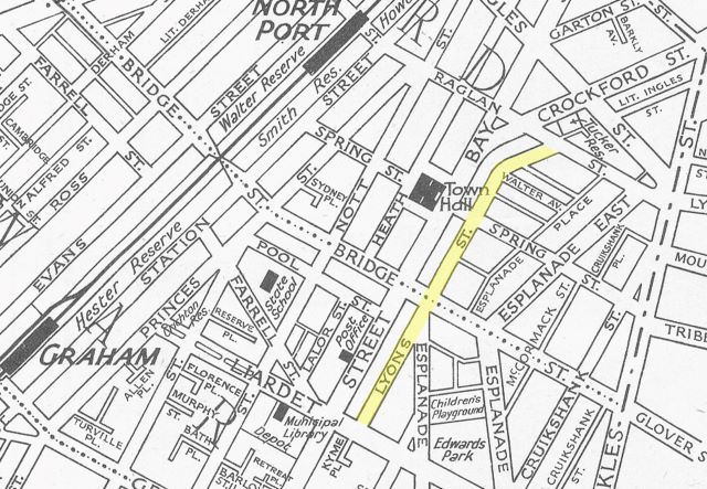
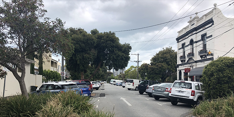
Lyons Street runs parallel to Bay Street, from Liardet Street over Bridge Street and Spring Street East before curving, parallel to Crockford Street, to intersect with Raglan Street. However, this was not always the case. The existence and evolution of Lyons Street reflect the physical geography and the development of Sandridge/Port Melbourne.
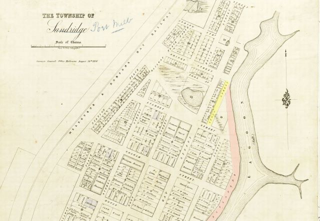
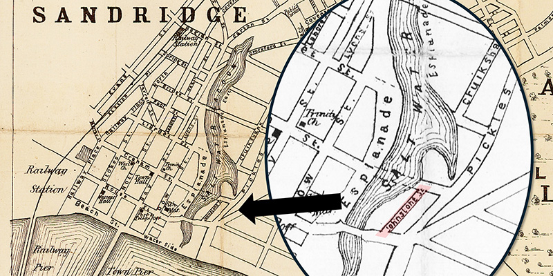
When Lyons Street first appeared it only went from Liardet Street to Bridge Street. As the 1856 map of Sandridge below shows, it intersected with the Esplanade, the western edge of Sandridge Lagoon. The creation of Lyons Street provided access to the rear of the properties on the eastern side of Bay Street north of Liardet (i.e. Section 20). It also provided the western boundary of Crown Land Section 19. This land was sold off in the mid-1860s and cottages appeared along Lyons Street by 1874.
After the land on the eastern side of the Lagoon was subdivided and sold off in the 1870s, the Esplanade became Esplanade West and the corresponding road on the far side was Esplanade East, as shown on the 1894 MMBW map below.
The upper portion of the Lagoon, from Bridge Street to Raglan Street, was progressively reclaimed during the 1870s and early 1880s and auctioned off in December 1883 and February 1884. The area shaded in blue on the MMBW map below shows the extent of housing construction that took place over the following decade in Sections 47A and 48A on Bridge Street, along the western side of Esplanade East between Bridge and Raglan Streets and along parts of Spring Street East. The land in Sections 47A and 48A just east of Esplanade West was not sold and formed part of the drainage system to take water runoff to a point south of Bridge Street.[1]
As was the case with Lyons Street, this portion of Esplanade West, from Bridge to Raglan Streets, provided rear access to the properties along Bay Street and the start of Crockford Street. There were no properties with frontage on this part of Esplanade West.
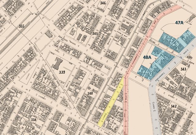
The Crown Land in Section 48A adjacent to Esplanade West was sold in August 1907. Simultaneously, this part of Esplanade West was renamed Lyons Street.[2]
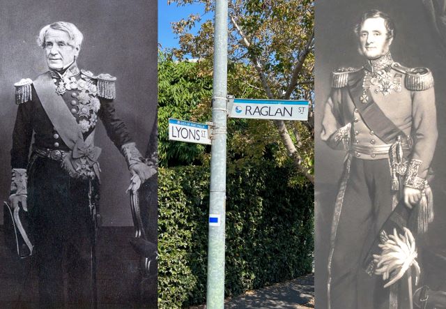
This just leaves the question of the name, Lyons. The date and the appearance of other streets named Lyons in the mid-1850s, in Williamstown and elsewhere, point to it being named after Vice-Admiral, Edmund, Lord Lyons (1790–1858). He was Commander in Chief of the British Mediterranean Fleet at the time of the Crimean War and played a critical role in the Siege of Sebastopol.[3] His army counterpart in the Crimea was Field Marshal FitzRoy Somerset, 1st Baron Raglan (1788-1855). Lord Raglan was killed in the fighting, the reason there are so many Raglan Streets around the place dating from that era.
The interesting feature of Lyons Street and Raglan Street in Port Melbourne is that they intersect, as did the lives of these two military men. Yet this was not planned when the two streets were each named in the mid-1850s. It was the unforeseen way the district developed over the next 50 years that caused these streets to come together.
Was this link between these two leaders in the Crimean War in the minds of those who decided to rename the part of Esplanade West that intersects with Raglan Street, Lyons Street? Was consideration ever given to creating a Nightingale Street?[4]
[1] David F Radcliffe, Changing Fortunes, Ebb and Flow of People and Place in a Pocket of Port Melbourne, PenFolk Publishing, 2020, Chapter 4.
[2] 1907 ‘THE TOWN COUNCIL.’, Standard (Port Melbourne), 17 August, p. 3., viewed 02 Apr 2024, http://nla.gov.au/nla.news-article164441651
[3] 1855 ‘DESPATCHES FROM LORD RAGLAN.’, Adelaide Times (SA), 4 September, p. 5., viewed 03 Apr 2024, http://nla.gov.au/nla.news-article207073231
[4] 1855 ‘WHO IS MRS. NIGHTINGALE?’, The Argus (Melbourne), 7 April, p. 6., viewed 03 Apr 2024, http://nla.gov.au/nla.news-article4806367
