Spring Street – North, South, East and West
David Radcliffe
For Victorians, Spring St is synonymous with the seat of government. Similarly, Spring St in Port Melbourne runs past our historical seat of local government, the Town Hall. What makes our Spring St unique is that it has four parts each named after one of the cardinal directions. However over the years the names of these four parts have swapped and changed several times. What is now Spring St North was once Spring St East, and what was once Spring Street West is now Spring St South. Another section of Spring St was initially named Spring St East, later becoming Spring St South and is now Spring St East again. Confusing.
This apparent identity crisis can be explained by the stages in its development. Spring St first appeared in maps of Sandridge in the 1850s; a time when the town was expanding rapidly along Bay St spurred on by the goldrush. This growth was constrained on either side by the NE alignment of the railway line (opened in 1854) and the upper reaches of the Salt Water Lagoon. One of the new cross streets that ran between these two bounding features was Spring St. There may have been a source of fresh water at its eastern end, near the present Town Hall, and hence the name, however the evidence in the contemporary maps is not conclusive.
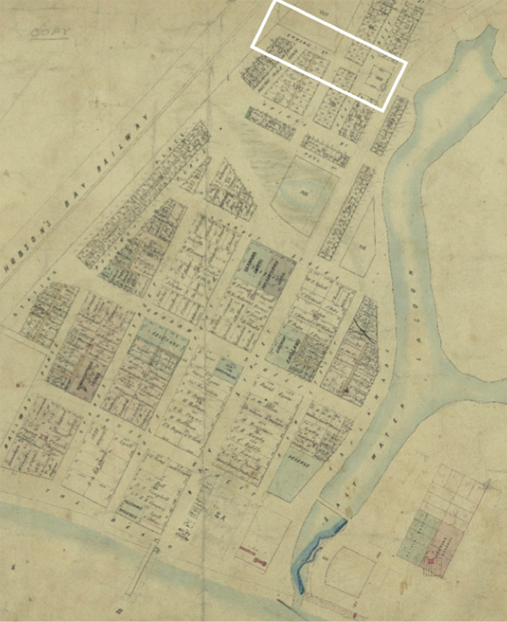
From the 1860s onwards various plans were put forward to extend Sandridge to the east of the Lagoon. When the land was finally subdivided and sold off in the early 1870s all the east-west streets in the borough had corresponding extensions created on the eastern side of the lagoon. Thus Spring St East came into being as shown in the 1878 map.
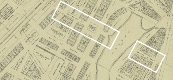
The “missing” piece of Spring Street was built in the early 1880s when the upper portion of the Lagoon was filled in. The resultant land was sold at public auctions in December 1883 and February 1884, just in time to feed the ‘Marvellous Melbourne’ land boom. By the mid 1890s, the original part of the street from the railway to the Town Hall was known as Spring St North. The parts either side of the Town Hall were respectively Spring St East (city side) and Spring St South (bay side) and the newer sections from Bay St across the former Lagoon to Pickles St was Spring St South.
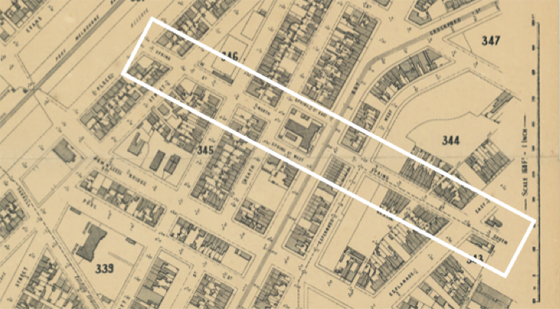
For most of the 20thcentury it was simply called Spring St, from one end to the other. More recently the cardinal suffixes were reinstated; however the designations shifted 90 degrees to what they had been in the 1890s. The four parts are now Spring St West (railway to the Town Hall), Spring St North (city side) and Spring St South (bay side) around the Town Hall and Spring St East from Bay St to Pickles St.
Another curious fact about Spring St is that there are very few houses on it west of Bay St. There are only three houses in Spring St West; 127, 135, and 137 or “Rock Vale”, the residence of George Sangster MLA at the time of his passing in 1915. On Spring St North there is just one house, no 98 and the only house in Spring St South is Clareville, the elegant former home of James Bartlett one time mayor of Port Melbourne who owned the Railway Club Hotel. This paucity of houses is a result of the close proximity to each other of the streets that cross Spring St, i.e. Station St, Princes St, Nott St, Heath St and Bay St. This caused the majority of housing allotments to front onto these longer streets rather than onto Spring St.
So the vast majority of houses, and hence residents, are in Spring St East from Lyons St to Pickles St, either side of Esplanade East. Most of these houses are modest Victorian worker’s cottages built in the late 1880s, quite a number bearing the signature of Thomas W Martin a builder / developer who also lived in the street for several years. The remainder are Edwardian cottages constructed in the early 1900s when the final parts of the Lagoon land were developed. Spring St East is framed by a magnificent vista of the front façade of the Town Hall, which was opened just as the street was being created and settled.
In 1902, the Salvation Army built its permanent Port Melbourne meeting hall in Spring St East. Interestingly the land had been acquired in 1896 by Herbert Booth, son of William Booth founder of the Salvation Army. The hall, which remained a feature of the street until 2007, also housed the Lady Foster Kindergarten from 1924 to 1928.
Recently, the residents of Spring Street East held a street party in the middle of what was the Salt Water Lagoon to celebrate community. This event had echoes of a much older tradition.
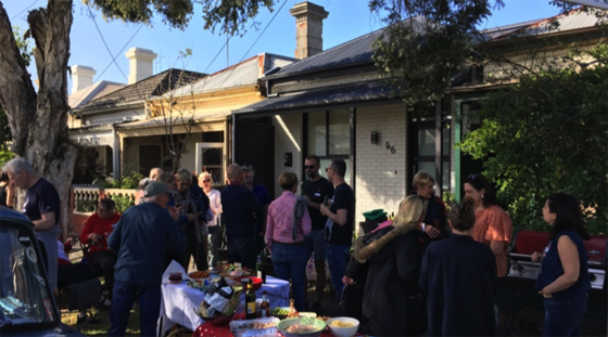
For millennia, the ‘people of the river’, the Yalukit-Wilam clan of the Boon Wurrung gathered in this place to enjoy the natural bounty of the lagoon, the nearby wetlands and the bay and to share stories.
