Cambridge Street
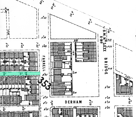
Passers-by today would find it difficult to identify the street highlighted in the above 1894 MMBW map. That’s because it doesn’t exist, although that is not strictly true. Part of the street is still there but it no longer intersects with Farrell Street.
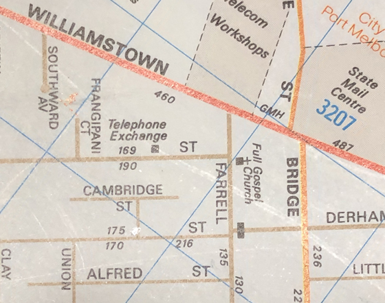
This is Cambridge Street. The origins of the name are unknown, but it is still there as a T-shaped street accessible from Albert Street as can be seen in the map section below, taken from the 1990 Melways Edition 20.
In the final decade of the 19th C, after the death of her husband, Thomas, Jane Slaven amassed a large number of houses in Port Melbourne including around Farrell Street, Bridge Street, Clark Street, Albert Street and, indeed, Cambridge Street.
Unfortunately many of these houses were in a rundown state and a lot were demolished in the mid to late 1890s, including Jane’s own house at 145 Farrell Street.
In 1902-3, Port’s local doctor, George Cuscaden, built a row of single-fronted cottages along Farrell Street, including the area occupied by the top end of Cambridge Street leaving us the T configuration we have today.
References:
2005 ‘Jane McKenna Slaven, entreprenuse? 1836-1916’, Women of Port Melbourne: Guide to the Exhibition, PMHPS 17-29 Oct 2005, p. 10
2005 ‘155 Farrell Street’, History of a Street Precinct, PMHPS, viewed 03 Jul 2019, https://www.pmhps.org.au/street-precinct/farrell155.htm
2 Comments
Charles Lawson
I can remember 1943 aprox when they built an Air Raid Shelter on the corner of Cambridge and Albert St working Day and Night time under floodlights Desperate times
David Thompson
Most interesting. As you say – desperate times – trying to protect a community from aerial attack. There is a relatively large block of flats on the northeast corner of Albert and Cambridge and I assume that was built on the site of the air raid shelter.